In 1968 was by the last of 51 planned bores discovered oil. Oil was discovered in the North Slope, located in northern Alaska between the Brooks Range Mountains and the Beaufort Sea (part of the Arctic Ocean). Together with pipeline was built the only road connection between oilfields and civilization Dalton Hwy.
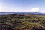
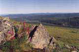
The road know also as the "Haul Road" is long 667 kilometers and begins at 132 kilometer on the Elliott Highway and ends at Dead Horse a few miles from Prudhoe Bay. The road and oilfields construction had taken seven years. Highway runs through four different nature zones: from Fairbanks to Coldfoot is a large area covered by alpine forest (boreal forest) and behind Yukon River follows endless plains of tundra. Brooks Range rise as high as 2 816 meters and by the way here leads Continental divide. This range blocked iced north winds in way to south. But the range stops also vegetation in spreading in northern direction. on descending plains grows only grass and on the grass roam herds of moose, caribous, wolf,...In Alaska live about 30 million moose's.
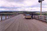
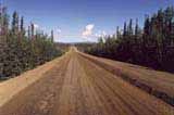
Only the road's beginning is paved. The road is still kind of under construction. Most of the road has gravel surface and can be quite rough, dusty or slippery depending on the weather. On the way north you will cross the magic Yukon River. This bridge is the only one over 3 185 kilometers long, fourth longest river in North America. The bridge is long 695 meters and almost 10 meters wide, to the bridge is attached pipeline. I was surprised by water's high temperature. I guess it was as water in a summer pond in Czech. Another paved section of road was around the Arctic Circle.
Because a shortage of time we went only to the Arctic Circle. Farther north especially around Brooks Range should be scenic even better. The road's condition should be worst behind the Brook range. It is very clever to visit information center before drive on the Dalton hwy. In visitor center you can get a booklet Discover the Dalton for free. Area along the road is almost uninhabited. Gas station and provision is possible to get just in a few places for higher prices and without choice possibility.
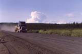
The primary users of this state maintained highway are the oil companies so that most of the vehicles using it are large trucks. These truckers are professional drivers but they also tend to take up a lot of room on the 9 meters wide road.
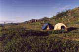
Several former camps where lived road constructers serves like campsites. But not all of them have drinking water.
In the area around Yukon River and Arctic Circle still live Athabasco Indians. Former small groupies lived like a nomad and they gathered only for winter. Although they settled down nowadays among their main resources are fishing, hunting and picking.
Along the road are old gold mines from early 20th century like villages Coldfoot and Wiseman.
Public open Dalton Hwy ends at Deadhorse. if you want to get as far as Arctic Ocean and oilfields you have to for last 10 kilometers take a bus. The ticket cost in 2002 $30.


