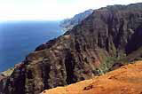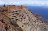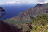
Koke'e State Park is on Kauai of Hawaiian islands and its altitude range is 1056-1386m. Park covers 4345 acres. Average temperature is circa 6.5ºC lower than by the ocean. This cool region was born from six million years of the fiery fury of Pele, the volcano goddess, who left Kaua'i after failing to find a suitable home. Legend says she left her footprint atop Pu'u Ka Pele along Waimea Canyon rim as she leaped eastward to O'ahu island. In this park during hikes on many trails through rain forest you can see many kinds of tree. From redwoods and Japanese sugi cedars planted by the C.C.C in 1930's to native maile and mokihana. Early morning walks offer glimses of rare native birds. Tracks vary in grade from gentle to moderate. Some of them lead to fishing and hunting areas. In western part of the park tracks lead to several beautiful overlooks over western coast. some parts of this coast is inaccessible on foot. Northwestern part of the island is called Na Pali Coast.
Very willing woman in the Koke'e Museu offered me to take careof my luggage during my hikes and gave me tips what to visit. She gave me also useful information about camping in Waimea Canyon.
Three track Nu'alolo Trail, Nu'alolo Cliff Trail and Awa'awapuhi Trail of total length 16 kilometers makes a loop. during this hike you will get to two spectacular overlooks with amazing view of coast. Along a whole hike there is not any water resource. Trails are descending in western direction to overlooks. The altitude difference is circa 300m. The trail heads are near the museum.

Most of the trails lead through tropical rain forest, some of them with a view into northern Waimea Canyon. There is several trails leading to Alaka'i Swamp area. This swamp lis on lava ground. High elevation protects native birds from diseases spreading by mosquitoes. Difficult climate conditions allowed only a few plants to settle here. Eastern part of the park is the wettest in the world and is there the islands the highest mountain Mt. Wai'ale'ale (1 730m).


