In 1968 was by the last of 51 planned bores dicovered oil. Oil was discovered in the North Slope, located in northern Alaska between the Brooks Range Mountains and the Beaufort Sea (part of the Arctic Ocean). This area lei behind arctic circle and for winter is frozen. A consortium of oil companies planning to produce the oil determined that a pipeline offered the best means to transport crude oil from the North Slope to a navigable port in southern Alaska where it could be shipped by tanker to refineries in the continental United States. The pipeline route covers 1 263 kilometers from Prudhoe Bay to the port of Valdez, the northernmost ice-free port in the United States.
Today is in Prudhoe Bay area on 24 000 kilometers of unpaved roads and pipes. In the centre of this oil complex is a little town called Deadhorse, support community for the Prudhoe Bay oilfields. That is also the place where TransAlaska Oil Pipeline starts. Pipeline crosses three mountain ranges and over 34 rivers and 800 streams. It leads through several seismic sensitive zones. The highest elevation point of pipeline is at Atingun Pass 1 422 meters.
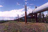
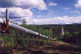
Because of the permafrost through most of Alaska, large segments of the trans-Alaska pipeline were elevated above ground to keep the permafrost from melting. Almost a half of pipeline is lifted. This allows also the game to roam freely. Somewhere, according to a soil's character, is pipe eight to ten meters underground. Pipeline construction began in March 1975 and was finished in June 1977. Crude oil began flowing in the pipeline on June 20, 1977 and the first tanker filled with North Slope crude oil left Valdez on August 1, 1977. During construction were built 29 basic camps for builders.

Through 122cm diameter steel pipeline runs 600 000 barrels per day. More than 14 billion barrels (nearly 550 billion gallons) have moved through the Trans Alaska Pipeline System since start up in 1977. The volume of oil flowing through the pipeline has decreased from a peak of 2.1 million barrels per day (mbpd) in 1988 to about 1 mbpd in 2001.
Along the pipeline are ten pump stations. They have power 100 000 liters per minute. The oil's speed is circa ten kilometers per hour.
Above-ground sections of the pipeline are built in a zig zag configuration to allow for expansion or contraction of the pipe because of temperature changes. The design also allows for pipeline movement caused by an earthquake. Pipes were made in Japan.
Pipeline runs "The Alyeska Pipeline Service Company", named after the Aleut word Alyeska meaning mainland, and wa established in 1970. The company is result of cooperation of seven oil firms: BP, ARCO, Exxon, Mobil, Amerada Hess, Phillips and Unocal. Today are among them just BP Pipelines (Alaska) Inc., ConocoPhillips Transportation Alaska, Inc.,ExxonMobil Pipeline Company, Unocal Pipeline Company and Koch Alaska Pipeline Company, L.L.C.
Whole project cost 7,7 billion dollars. Bridge over Yukon River was built in 1974-1975 and cost 30 million dollars. Open to the public was in 1979.
Together with pipeline was built the only road connection between oilfields and civilization Dalton Hwy.


