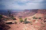
The heart of the arid stone wilderness in southern Utah is preserved like a Canyonland National Park. The park's shape was made mostly by rivers, Colorado river in few million years since its birth has carried away the remains of solid rock three kilometers thick from area almost the size of France. With the abrasive force of all this rocky sediment have created together with it's tributaries deep canyons and shaped the unique landskape.
The Canyonlands national park is devided by Colorado River and Green River into three sections: The Needles, Island In the Sky and Maze.

Island In the Sky - offers amazing view of rivers flowing through deep sharp canyons. The Island is the easiest district to visit in a short period of time.
Maze - former called by Indians "Land of Standing Rocks" is the the most wrinkled park's part. The temperatures may range from -30°C to 45°C. Although there are some grasslands here and shrubs, this is mostly bare slickrock country. Your feet slip on naked stone covered at most by a few centimeters of sand dust. vrstvou písku.
But in a long future this picture can be changed. We can find even in such dry rocky ground first pieces and colonies of mosses, plants living in shadows of rocks and in cracks. It can take even more than 50 years to a msall pathc of osil to develop. Although snakes live here too not so many like in others deserts of the Southwest. Most common are lizards, spiders and insect.
The Neddles - The Needles District forms the southeast corner of Canyonlands and was named for the colorful spires of Cedar Mesa Sandstone that dominate the area. This area has the most various scenic and life-forms. For most of the year two streams have a running water and by theris springs grow cottonwoods. This tree survives even if water is deep in underground. In 19th century tamarisk spread here, this plant was imported from Egypt. Today it is the most common plant along Colorado River. In this part of the park we can see remains of Native Americans settlements from 1000-1300 A.D. period. These are not in such a good shape like in Mesa Verde.
First people came to area of today's Canyonland National Park in 7000 B.C. Nomadic groups of hunter-gatherers roamed throughout the southwest from 8,000 B.C. to 500 B.C. Living off the land, these people depended on the availability of wild plants and animals for their survival. They do not appear to have stayed in any one area for very long. They left a great deal of intriguing rock art. Some of the best examples of their art, known as "Barrier Canyon Style" remain on the cliff walls of Horseshoe Canyon in western part of the park. The Ute and Paiute cultures may have arrived as early as A.D. 800. The Navajo arrived from the north sometime after A.D. 1300. All three groups still live here today.
Each park's section has its own visitor centre. To drive from one section to another takes at least a half day. Hiking in this park is only for experienced hikers.


