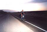
Notice.: Time - includes a short stops for traffic lights, a map´s study ..)
| Day | 8. |
| Date | 29.9.2001 |
| Distance [miles] | 21,6 |
| Time | |
| Average speed [miles/hour] | |
| Total Distance [miles] | 234,8 |
Today it's Kevins' last working day. We decided to climb Mt. Whitney together. So during morning I am visiting Alabama Hills.
This hills are west of Lone Pine and exactly through them is facings 20km long uphill road ending in Whitney Portal. At Whitney Portal (2 744m) starts John Muir Trail heading to the summit of the highest mountain in "lower 48" - Mt.Whitney(4 418m).
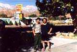
At 6 pm is Kevin at least ready to go. It is a full moon. The trail is not in difficult terrain so we are hiking without flashlights. Then we can see more and enjoy the beauty of tall rocks bathing in moonlights and weltering in deep silence. But the whole trek is difficult. Just one way to the summit is long 35km with 2km change of altitude. That is the reason why we are still passing tourists who are coming back. When reaching first camp - Outpost Camp we are in good mood and condition. Ok, let's go to the other camp says Kevin, it is not so far. We are passing the mirror Lake. After an hour I am getting tired so I ask Kevin where is that camp. I can not believe it. Ranger who has been working here for more than four months did hike on this trail just one time and at night. After some time which seems to me like endless, we see a few tents ahead. Uff. We sleep in Trail Camp. This camp is also the last point with water. But even this water you have to boil or fit for drinking. This night I sleep for me so far in the highest elevation - 4 000m and we hiked 13,6km at moonlight.
| Day | 9. |
| Date | 30.9.2001 |
| Distance [miles] | 16 |
| Time | |
| Average speed [miles/hour] | |
| Total Distance [miles] | 250,8 |
Mt. Whitney is probably the most popular mountain to hike in the whole USA. That is the reason why the amount of people allowed to climb is restricted by rangers. You can get a free permit in Lone Pine. The limit is 150 for day-hike and 50 for an overnight hike. They can oversleep either at Trail Camp or Outpost Camp. If you are going to oversleep in nature you should use BRFC - bear-resistant food container that is possible to buy or rent at ranger's station. In this area, you can see black bears. On weekends people have to usually wait for a permit because of the demand. Mt. Whitney is located in SequoiaNational Park and last 5km of John Muir Trail is leading along eastern border of the park. Climbing this mountain I can just recommend.
| Day | 10. |
| Date | 1.10.2001 |
| Distance [miles] | 77.13 |
| Time | 6:38:37 |
| Average speed [miles/hour] | 11,7 |
| Total Distance [miles] | 328 |
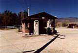
After three days when I have been gathering information and thinking over next destination I have to decide. Ranger told me: "It is getting colder now for the next three days. Well, if I brought a bike I should use it. I would not rent a car for The Death Valley and I will go there by bike. I am buying an extra bottle of water and in a small village Keeler at the post office I am filling up all of them. I have 7.5 litres at all. Noticed on an abounded gas station says "No Gas"....
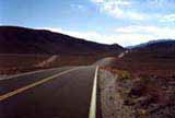
Death Valley National Park is larger than just Death Valley. Park includes also Panamint and Amargosa ranges. So before I can get to real "Death Valley" I have to pass several long uphills like for example 17 km long one from Panamint Valley up to Towne Pass with 1 km elevation change. It is pretty hot even here. I have to take a rest for an hour in shadow behind a big rock. I am back on the road when it is about sunset. The sky is clear and my friend moon is lighting my way. I want to camp at Emigrant Camp, which I know from my earlier trip. Using the lightest gearing I keep going. I am just walking my bike the last part of uphill as the speed is the same. After half an hour I can at least feel the summit in my legs. In the next downhill I am reaching my maximum speed - 80km/hour. Light on a table of some Czech family camping in Emigrant Camp is visible from a long distance. So I did not need to worry about missing the camp. After a short dinner in their company I am ready to sleep. In this camp is drinkable water, the elevation is 600m.
| Day | 11. |
| Date | 2.10.2001 |
| Distance [miles] | 49,8 |
| Time | 4:00:43 |
| Average speed [miles/hour] | 12,4 |
| Total Distance [miles] | 377,8 |
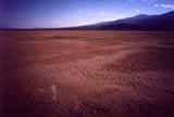
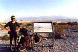
In Emigrant Camp I fill up al the bottles of water and with sunrise I am going long downhill. With changing elevation I can feel warming air. I stop just for a shortstops by Sand Dunes and at Harmony Borax Works.I would like to be at the Visitor Center before noon. Temperature is 43°C and so I decided not to go to the lowest point in the western hemisphere at Badwater. it would be just 50km extra and I told to myself: "I do not need to have everything". I am watching people, taking rest and meeting another biker from Italy. He is carrying 11 litres of water. Well, contrast to me he is driving bike every second day in dolomite, Italy so he can do that. Both are leaving the bottom of Death Valley with sunset. This time I am sleeping just by the road, again at an elevation around 600m.


