


Notice: Time - includes short stops at traffic lights, studying the map, etc.
British Airways carried my bike as a second piece of luggage free of charge again. The bike had to be partly disassembled and packed in a cardboard box or a special bike case.
First of all, I have to say thank you again - this time to my friends Carol and Sid. My bike trip was part of a journey lasting more than four months during the summer of 2001. You can read more about it here.
| Day | 1. |
| Date | 22.9.2001 |
| Distance [miles] | 5,1 |
| Time | 0:30:20 |
| Average speed [miles/hour] | 10,2 |
| Total Distance [miles] | 5,1 |
On 22 September 2001, I left Palo Alto (Silicon Valley) with Carol and Sid for Yosemite National Park. We passed one of the Los Angeles aqueducts, which carry water from the Sierra Nevada to Los Angeles. I have to say that Sid was right - the trip across the Central Valley would not have been very interesting, especially in such hot weather. Sid and Carol saved me a couple of days and a lot of energy. By evening, we reached Glacier Point. Glacier Point offers a wonderful view across Yosemite Valley. At sunset, you can see Half Dome glowing beautifully in the red light.
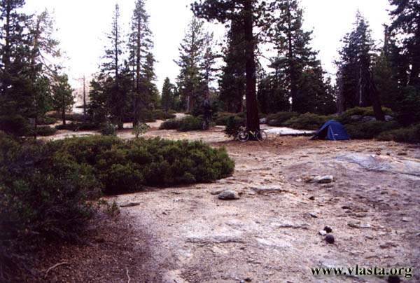
Unfortunately, I was under time pressure. I preferred to set up camp before sunset, and when I returned to the lookout, it was too late. The colourful show was over. At least I had a quiet night near the summit of Sentinel Dome (8,740 ft).
I was travelling on my TREKKING FOX - HOT SHOT again, and the bike equipment was almost the same. Because I had not used a flashlight during my "New England" trip, I did not bring one with me this time. Fortunately, before I left Palo Alto, I borrowed one from Carol. This time it was really necessary. The conditions were completely different - poisonous snakes, spiders, extreme heat - and sometimes I travelled at night....
| Day | 2. |
| Date | 23.9.2001 |
| Distance [miles] | 42.79 |
| Time | 2:33:37 |
| Average speed [miles/hour] | 15.8 |
| Total Distance [miles] | 47.9 |
In the morning after breakfast, I went to the summit of Sentinel Dome. The summit is beautiful and definitely worth visiting. There were not many people there, and the view was similar to the one from Glacier Point. I was surprised by the warm weather - I guessed it was around 85-90 F, even though I had been worried about snow. After seven almost flat miles, I enjoyed a thirty-mile downhill ride to the bottom of Yosemite Valley. Because I had decided to climb Half Dome the next day and needed a safe place for all my belongings, I pitched my tent at a campground. The campsite cost $18 per site and was mainly used by climbers. For the rest of the day, I wandered around the eastern end of the valley. Among other things, I encountered a "King Snake".

| Day | 3. |
| Date | 24.9.2001 |
| Distance [miles] | |
| Time | |
| Average speed [miles/hour] | |
| Total Distance [miles] | 47.9 |
Around 8 a.m., I left the campground and started the seven-mile one-way hike to the summit of Half Dome. The trail leads through beautiful scenery along the Merced River. I chose the steeper and shorter trail, which passes closer to Vernal Fall
. Soon afterwards, I passed the second famous waterfall - Nevada Fall. Both can be seen from Glacier Point. The Merced River runs through Little Yosemite Valley. Next time, I would like to camp here at the official backpackers' campground. It is farther away from crowded Yosemite Valley, and you can hike to less popular places. For hikers climbing Half Dome, this is the last place with running water. The sun was burning and it was very hot. It seemed that I would not reach the summit until the afternoon, so I had to conserve my water.
From a rocky "hump" east of Half Dome, there is a beautiful view over "Paradise Garden" - or, as a Czech girl I met there called it, the "golf field". On the final section of the trail, you have to use two cables to reach the summit. It looks worse than it really is. In fact, I found it easier than walking on the steps carved into the rock. It took me no more than about 10 minutes, although it depends on how many people are there. At the beginning of the cables, there was a pile of gloves that hikers could use. I did not use them because they seemed too slippery.
| Day | 4. |
| Date | 25.9.2001 |
| Distance [miles] | 16,29 |
| Time | 2:13:59 |
| Average speed [miles/hour] | 7.8 |
| Total Distance [miles] | 64.2 |
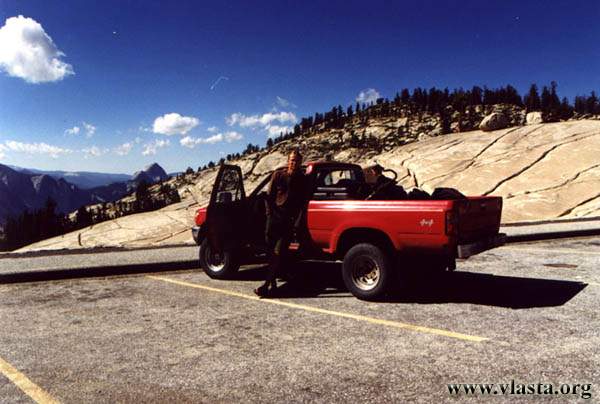
There was a wonderful storm throughout the night. I enjoyed listening to the thunder echoing through Yosemite Valley. Luckily, the storm was over by sunrise. I had to get up early because the night before I had damaged my bike and also had a flat tire. I was in a hurry because I had to repair it and meet my new friend at 9 a.m. While climbing Half Dome, I had met a Czech guy named Tomáš who had a car. He was travelling alone and was willing to take me across the mountains. I made it in time, and we drove east to Mono Lake and Bodie, one of the best-preserved ghost towns in the West. We parted in Lee Vining.
A strong wind was lifting so much dust that it covered the entire eastern horizon. Unfortunately, it was blowing against me. I was not even sure how much water I should take because this would be my first time cycling through the desert, and I did not know what water sources were available along the road. The only thing that reassured me was that I had read about other cyclists riding this road in the same direction. I was not very eager to start pedalling, but what else could I do? I bought one more bottle of water and headed south. The road climbed slightly, but the wind slowed me down considerably. After about 20 km of climbing, I reached Deadman Pass, where I found a suitable place to camp.
| Day | 5. |
| Date | 26.9.1999 |
| Distance [miles] | 35 |
| Time | 1:58:19 |
| Average speed [miles/hour] | 13.5 |
| Total Distance [miles] | 99.2 |
The night was cold, which was not surprising because I was at an altitude of 2,600 m. But within an hour after sunrise, it was already quite warm. The road was flat or slightly downhill, and I was in no hurry. Around noon, I left the paved road and followed a dirt road to the Hot Springs. This hot spring area is situated southeast of the famous ski resort of Mammoth Lakes, about 7 km east of Route 395. Only the nearest springs at Hot Creek are marked. You can even fish here, but camping is prohibited. Sid and Carol had told me about some "baths" built by local people. These baths are not marked and are scattered around the area. I asked some people there, and they told me that the best one was another 8 km away. Camping was allowed there, but there was no drinking water. They gave me two litres of water, so I stayed there for another night. It was even better because there was a nearby forest providing some shade...
| Day | 6. |
| Date | 27.9.2001 |
| Distance [miles] | 63.5 |
| Time | 4:46:51 |
| Average speed [miles/hour] | 13,2 |
| Total Distance [miles] | 162.7 |
After another cold night, it quickly became warm. I continued heading south. Before Bishop, I enjoyed a nice 17 km downhill ride. Great! Bishop is the only sizeable town for a long distance, so it even has a supermarket, the Paiute and Shoshone Museum, and a pleasant park where I decided to rest in the shade of the trees during the midday heat. In the afternoon, I took another bath in the Hot Springs south of Bishop.
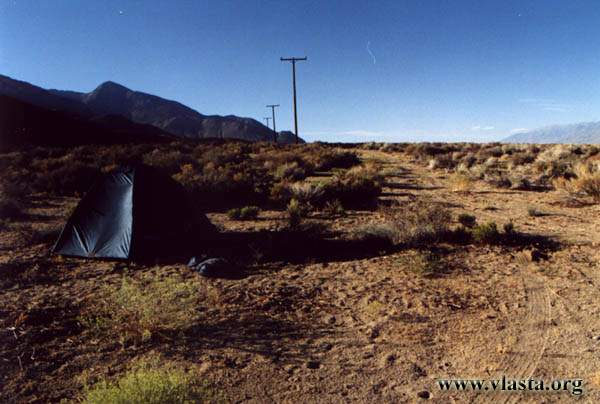
Camping was prohibited by this hot spring. In the whole Owens Valley, however, it was not difficult to find an open place, so a short distance away I was able to pitch my tent. The altitude was now around 1,300 m, which meant that it was hot even at night. I had been warned to watch out for rattlesnakes, scorpions, and other creatures, so I kept my tent closed all the time. You never know.
| Day | 7. |
| Date | 28.9.2001 |
| Distance [miles] | 51,14 |
| Time | 3:22:13 |
| Average speed [miles/hour] | 15,1 |
| Total Distance [miles] | 213,8 |
Today, I wanted to reach Lone Pine, where my friend Kevin was working. I had met him in Denali the previous summer. This time, Kevin was working here as a Ranger. His area of responsibility also included Mt. Whitney (4,418 m) - the highest mountain in the "lower 48" - and I was here to climb that peak.
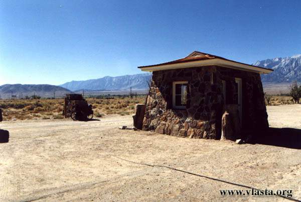
But before I got there, I made a short stop at the Manzanar National Historic Site. Manzanar was one of ten war relocation centres where Japanese American citizens and resident Japanese immigrants were interned during World War II. In the months following the attack on Pearl Harbor, approximately 120,000 people were taken under military guard to assembly centres and then to ten internment camps, often with no more than they could carry in two suitcases. Most came from California, Washington, and Oregon. Some remained in the camps for almost three years. Manzanar was established in March 1942. A total of about 11,400 people passed through the relocation centre before it closed in November 1945.